
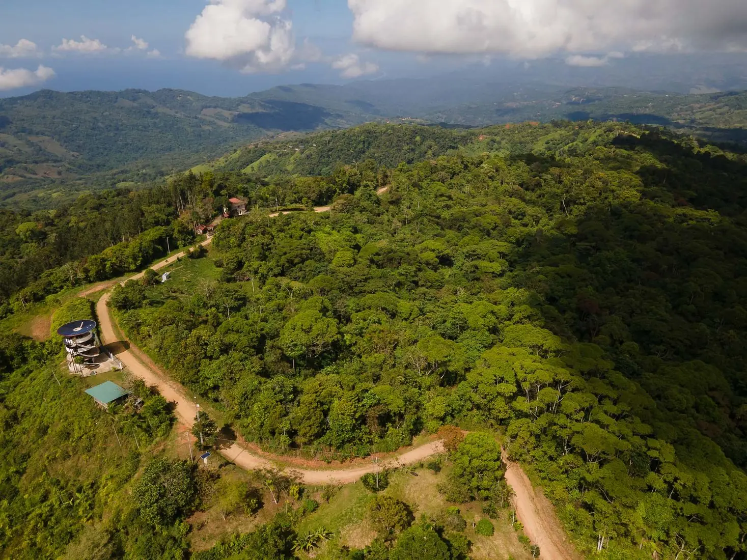
Pérez Zeledón's Road to the Sea
Barú begins about 16 km southwest of San Isidro de El General, where Route 243 leaves the valley, and ends a few kilometres above the Pacific at Dominical. Its seat is Platanillo, some 21 km from the city and only 13 km from the beach.
Most of Pérez Zeledón looks inland, toward the Talamanca range and the summit of Chirripó. Barú looks the other way. From its ridges, on a clear morning, you can see the Fila Costeña fall away toward the ocean, and every river here runs west to meet it. The district even takes its name from one of them: the Barú River, which reaches the sea at Dominical beach.
It is one of the emptiest corners of the canton. Fewer than three thousand people live across almost 190 square kilometres of forest, pasture and steep valleys, roughly fifteen per square kilometre. Yet this is the district that most foreign visitors to Pérez Zeledón actually see, often without knowing its name. They come for Nauyaca. They leave having crossed Barú from end to end.
Down the 243, Village by Village
The easiest way to understand Barú is to drive it. The road climbs out of the valley of El General, crosses the ridge and starts the long descent to the coast. Each stretch has its own village and its own character.
Tinamaste
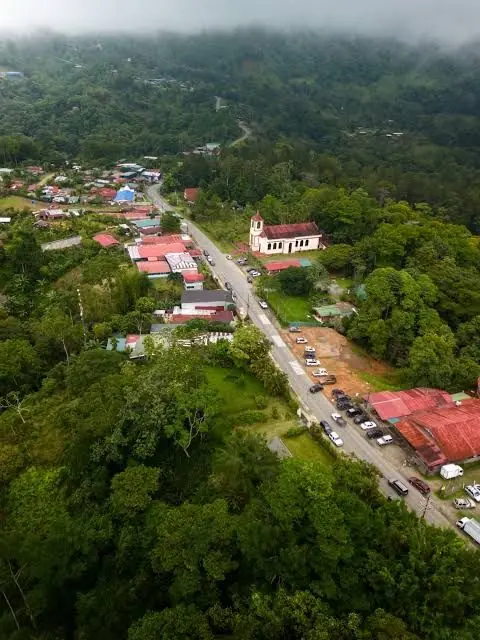
The first village of the district, strung along the road with its church right on the 243. Also called San Cristóbal in the official records. Cool, green and often wrapped in cloud.
Tinamaste · AlfombraLas Tumbas
A quiet valley south of Tinamaste, with its own small church and pastures under the forest. Above it hang the Diamante waterfalls, which only local guides take you to.
Las TumbasPlatanillo
The centre of the district: school, community hall on the main road, sodas and the turnoffs to Nauyaca and La Ceiba. The valley of San Juan de Dios, crossed by the Guabo River, opens just beyond.
Platanillo · San Juan de Dios (Guabo)Chontales
The high, remote north-west of Barú, reached by back roads about an hour from San Isidro. Farms, forest and the tall Eco Chontales waterfall.
Chontales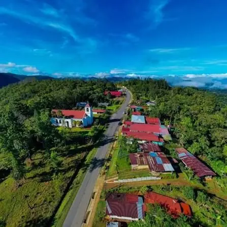
A Road Drawn in 1941
Barú's story is the story of a road. Long before there was a district, there was a line on a map between the valley and the sea.
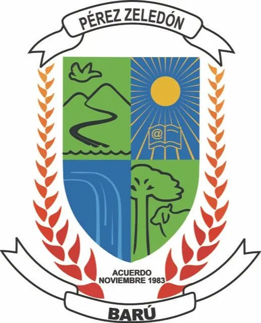
From the Mountain Toward the Sea
Barú's shield could almost be a map of route 243. In the first quarter, a road winds down a green mountain toward the water, with a bird in flight above it, the same descent the highway makes from the valley toward the Pacific.
Beside it, the sun shines over an open book marked with an @, a nod to learning in a connected age. Below, a waterfall, for the cascades that made the district famous, and a tall forest tree. Red and orange laurels frame the shield, and the ribbon reads simply Acuerdo, noviembre 1983: the executive agreement that created district 09.
In July 1941 a surveyor named A. Araya finished a plan for "the construction of a road between Dominical and San Isidro del General." The drawing, on onion-skin paper at a scale of 1:40,000, is still kept in Costa Rica's National Archive. At the time San Isidro was a young town with no paved link to anywhere, and the idea was simple: open the valley to the Pacific.
That road became today's Route 243, 33.4 km from the Inter-American Highway at San Isidro to the Costanera at Dominical. It was first developed as an access route for the construction of the Inter-American itself, a way to move materials and machinery into the valley. The villages grew along it: Tinamaste, Las Tumbas, Platanillo. For decades they belonged to the district of San Isidro de El General, governed from a city on the other side of the mountain.
On 3 November 1983, Executive Agreement 232 separated them. The new district took the name of the river that drains it and chose Platanillo as its seat. It was the first new district the canton had added in thirteen years, since Cajón in 1970. Río Nuevo and Páramo would follow in 1984.
- 1931
Pérez Zeledón is created with four districts. The land of Barú belongs to the district that is today San Isidro de El General.
- 1941
July: the plan for a road between Dominical and San Isidro del General is drawn. It is kept today in the National Archive.
- 1970
Cajón becomes district 08. The canton will not add another district for thirteen years.
- 1983
3 November: Executive Agreement 232 creates Barú, district 09, from San Isidro de El General, with its seat in Platanillo.
- 2011
The national census counts 2,393 residents.
- 2022
The census counts 2,862 residents, about one in five more than in 2011. Nauyaca, Diamante and Eco Chontales are by now among the best-known waterfalls in southern Costa Rica.
Where the Mountains Break Open
The Fila Costeña drops to the sea in a very short distance, and the water has to get down somehow. The result is a district where almost every valley ends in a waterfall. These are the ones worth planning a day around.
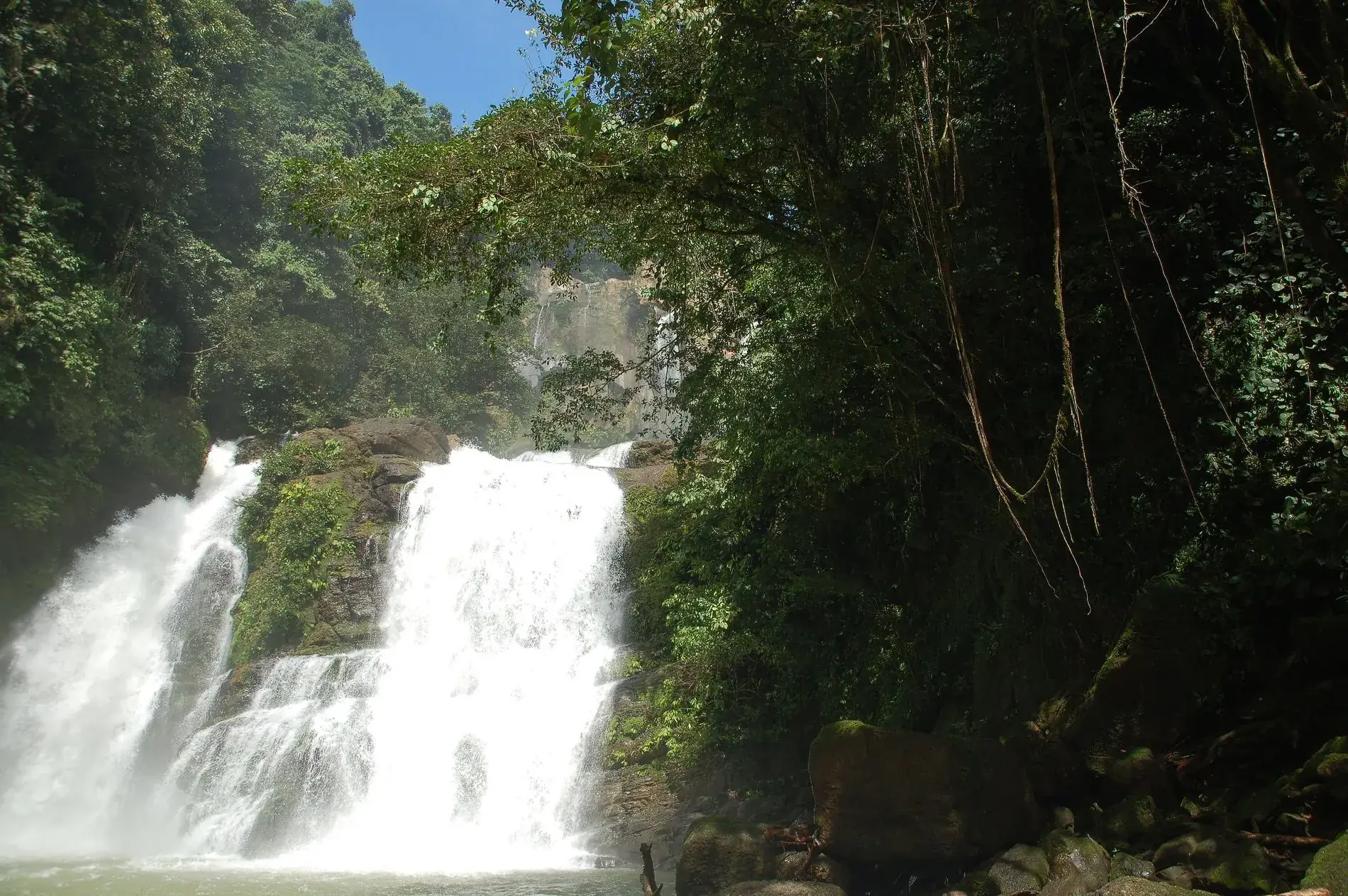
Nauyaca Waterfalls
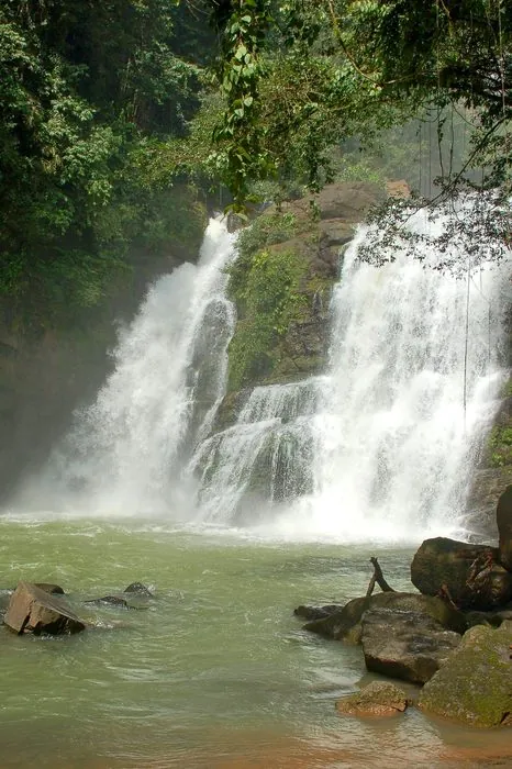
The most famous waterfall in the canton is in Barú, about 2 km southwest of the Platanillo school. Two drops on the Barucito River, according to the Costa Rican Tourism Board: an upper fall of 45 metres in free fall and a lower, stepped one of 20 metres. Below them spreads a pool of some 1,000 square metres and six metres deep, inside a canyon about 80 metres wide.
It is a Costa Rican family business. You can hike in (around 4 km each way), ride a horse or take a pick-up through the farm. Many tours sell it from Dominical or Uvita, but it is 25 km from San Isidro.
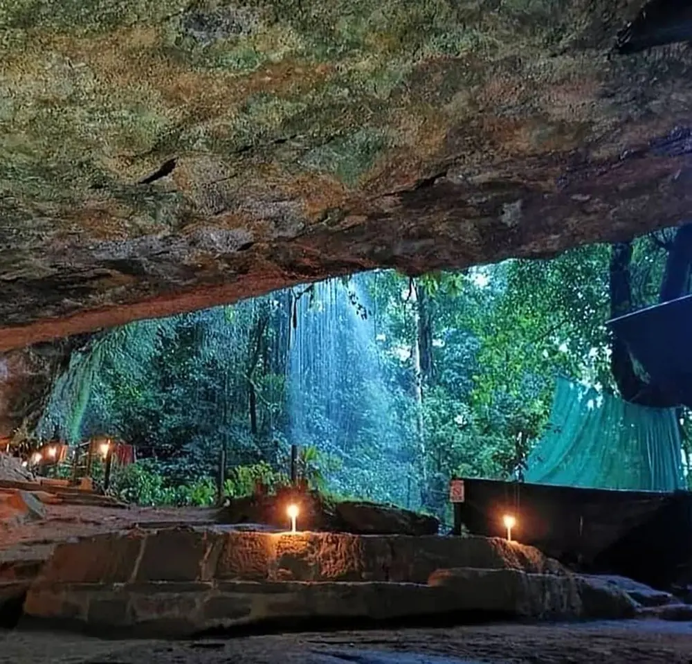
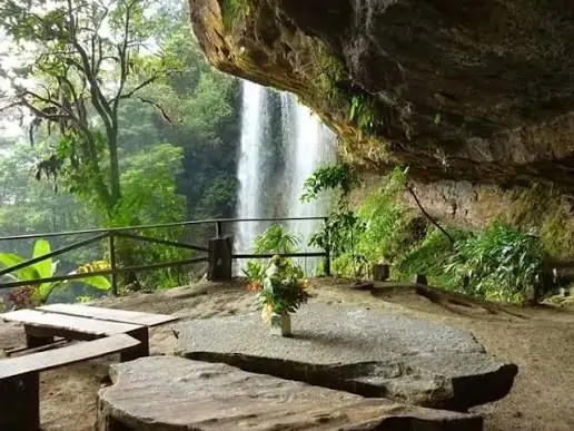
Diamante Waterfalls and the Stone House
Above the village of Las Tumbas, near Tinamaste, a local family owns a mountain with some ten waterfalls, much of it primary forest that has never been cut. The main Diamante fall is often called the tallest in Costa Rica. The hike up is hard: more than 3 km and around 800 metres of climbing on gravel, clay and earth steps, about two and a half hours.
The reward is the Casa de Piedra, a cave behind twin falls of about 26 metres, fitted with a kitchen, sleeping platforms and bathrooms. You can visit for the day or spend the night inside the mountain. The family no longer allows independent visits: book with their guides.
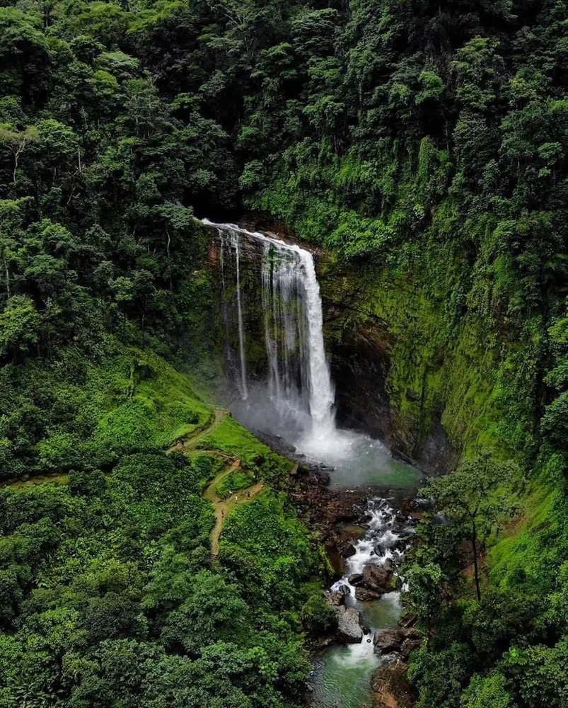
Eco Chontales Waterfall
Far from the main road, in the mountains of Chontales, a single column of water falls 65 metres into a string of pools two to four metres deep. The self-guided trail is only about 700 metres, 12 to 15 minutes on foot, gently sloping.
It is a rare combination: a very tall waterfall with an easy walk, a restaurant, camping and rooms, and a fraction of Nauyaca's crowds. It opens every day from 8 a.m. to 4 p.m.; pets are not allowed. Look for it on Waze as "Eco Chontales Waterfall."
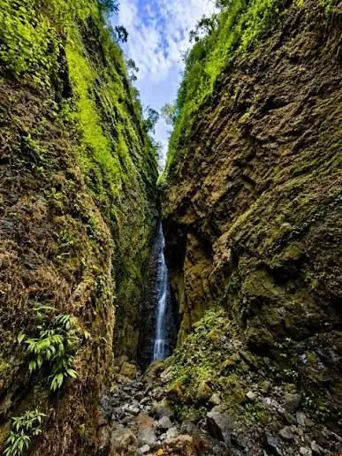
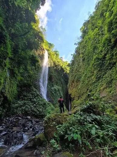
El Abismo Canyon
Barú's newest secret is not a viewpoint but a crack in the mountain. El Abismo is a narrow canyon on a private farm, its walls so close and so covered in moss and ferns that the sky becomes a strip of blue overhead. At the end, a waterfall slides down the rock.
It is visited only with hiking groups: a wet route of about 9 km and five to six hours, walking through the river, of intermediate difficulty. You do not need to swim, but you do need clothes and shoes that can get soaked.
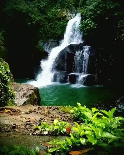
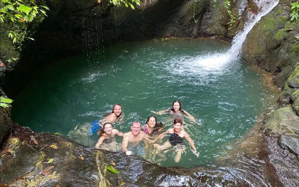
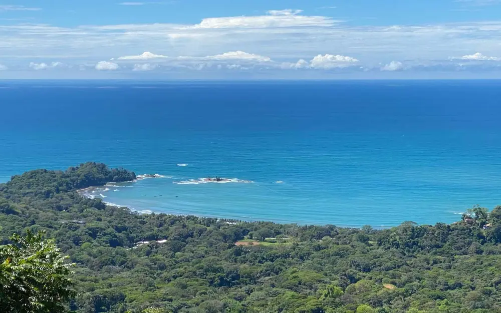
Hacienda Ébano
A Costa Rican family has kept this farm since 1970. Don Régulo and Doña Judith started with crops and cattle; their family later turned part of the land into a private nature reserve for conservation, education and ecotourism. It sits in the Platanillo area of Barú, on Route 243 about 10 km above Playa Dominical, and it belongs to the Paso de la Danta (Tapir Path) Biological Corridor.
Its signature outing is a safari-truck ride and rainforest hike to a double waterfall with a pool for swimming, finished with a farm-style lunch wrapped in banana leaves beside the water. Guides point out poison dart frogs, monkeys and birds along the way, and the upper farm looks straight out to the Pacific. There are also guided hikes, a birdwatching walk, a night hike, a sunset tour with coffee and a combination with Nauyaca. Its restaurant opens Wednesday to Monday, 11 a.m. to 8 p.m.
Photos: Hacienda Ébano.
More waterfalls in Barú, from the municipality's inventory: Catarata La Rana Roja (Platanillo, at La Rana Roja Ecolodge), Catarata Elysiana (Platanillo, 8619-0439) and Catarata El Encanto (Florida). Many are on private land and unmarked: always call before going, and never enter a farm without permission. See all of them on our waterfalls page.
Villages That Live Between Two Worlds
Barú is cattle, small farms and forest, and more and more it is also guides, lodges and sodas that feed the visitors going to the falls. Half an hour from the city and twenty minutes from the beach, its villages keep the rhythm of the countryside.
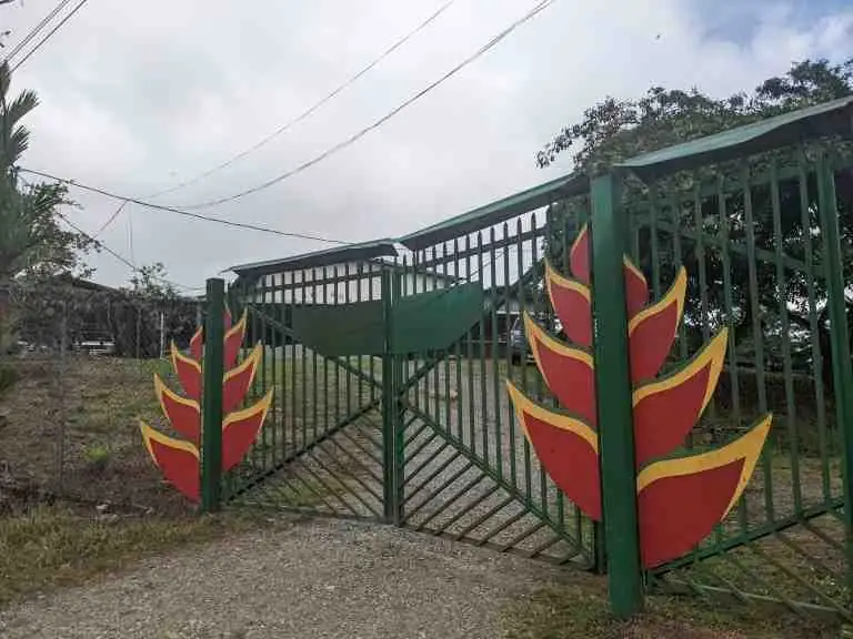
Platanillo Community Hall
Platanillo · On the main roadThe social centre of the district, beside the Barú tourist stop on Route 243. It holds about 600 people and hosts dances, celebrations and family parties. It is run by the Platanillo Integral Development Association.
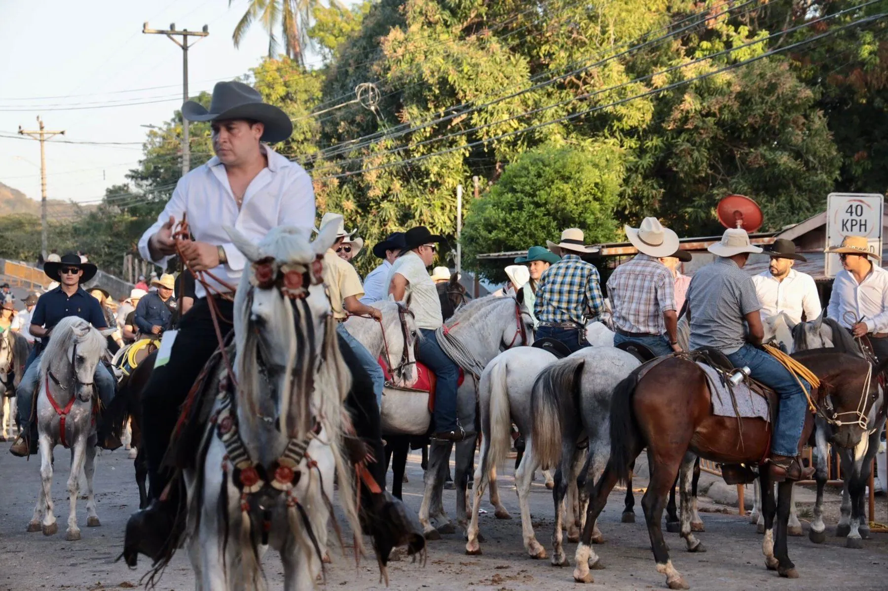
Carrera de Cintas in Tres Piedras
Tres Piedras · JulyA traditional ribbon race on horseback: riders at full gallop try to spear a small ring hanging from a line. It is one of the classic dates on the canton's rural calendar.
Where to Stay
Nauyaca · Tinamaste · PlatanilloThe hills of Barú are cooler than the coast and closer to the falls. Our lodging guide includes the best-rated property in the whole canton, a short walk from the Nauyaca entrance, plus small farm stays in the area.
Platanillo and Its 28 Villages
As listed in Costa Rica's official territorial division. Tres Piedras is shared with a neighbouring district.
Platanillo
District seat on Route 243, with the school, the community hall and the turnoff to Nauyaca.
Tinamaste
Also San Cristóbal. First village from San Isidro, with its church on the highway.
Tumbas
Valley below the Diamante waterfalls, with its own church.
Chontales
High north-west, home of the Eco Chontales waterfall.
San Juan de Dios (Guabo)
Valley of the Guabo River, just past Platanillo.
Tres Piedras
Shared community, known for its July carrera de cintas.
Florida
Home of Catarata El Encanto.
Alfombra
Near Tinamaste, known for its wide views.
Barú · Barucito
Villages that share their names with the district's rivers.
And also
Alto Perla, Bajos, Bajos de Zapotal, Cacao, Camarones, Cañablanca, Ceiba, Farallas, Líbano, Magnolia, Pozos, Reina, San Marcos, San Salvador, Santa Juana, Santo Cristo, Torito, Villabonita and Vista Mar.
Getting There
From San Isidro: take national Route 243, the San Isidro–Dominical road, which leaves the Inter-American Highway at the southern edge of the city. Tinamaste is about 16 km (25 minutes) away, Platanillo about 21 km (35 minutes) and the Nauyaca area about 25 km (40 minutes). Keep going and you reach Dominical beach about 13 km after Platanillo.
Good to know: the 243 is paved but mountainous, with many curves and frequent fog around Tinamaste; drive with lights on. Chontales and Las Tumbas are reached by rural roads, and Eco Chontales is about an hour from San Isidro. Hospitals, banks and supermarkets are in San Isidro. Nearby districts worth combining: Daniel Flores on the way out of the city and, across the provincial line, the beaches of Dominical and Uvita (see our sister site PuraOsa.com).
About Barú
When was the district of Barú created?
On 3 November 1983, by Executive Agreement 232, from the district of San Isidro de El General. It is district 09 of Pérez Zeledón.
What is the seat of Barú?
Platanillo, on Route 243, about 21 km from San Isidro de El General and about 13 km from Dominical.
Are the Nauyaca Waterfalls in Pérez Zeledón?
Yes. They are in the district of Barú, about 2 km southwest of the Platanillo school, even though many tours sell them from Dominical or Uvita. From San Isidro they are about 25 km by road.
How many people live in Barú?
2,862 according to the 2022 census, compared with 2,393 in 2011, across almost 190 km². It is one of the least populated districts of the canton.
Can I visit the Diamante waterfall without a guide?
No. It is on private land, on very steep terrain, and the owning family only allows guided visits, either for the day or with a night in the Casa de Piedra cave.
Is Hacienda Barú in the district of Barú?
No. The Hacienda Barú refuge is on the coast near Dominical, in the province of Puntarenas. It shares the name because that is where the Barú River meets the sea.
How do I get to Barú from San Isidro de El General?
By national Route 243, the San Isidro–Dominical road. Tinamaste is about 16 km (25 minutes) away and Platanillo about 21 km (35 minutes).
Sources: Costa Rica's official territorial division, INEC, Costa Rican Tourism Board (ICT), National Archive and the Municipality of Pérez Zeledón. Hours and access change: confirm before you go.
Waterfalls, Cloud Villages and the Road to the Sea
Map every waterfall in the canton, or see how Barú fits into the rest of Pérez Zeledón.
Updated